The bitter north wind roars through the bare limbs of the trees along the ridge line above our position causing them to sway and creak. The ridge acts as a natural wind break for the side of the mountain we occupy and tiny snowflakes fall silently around us. We lie in the prone on the cold wet leaves of the forest floor, feeling uncomfortably exposed in the sparse underbrush, each of us intently watching down the mountainside toward our back trail.
I think to myself how once I gave the listening halt and the hasty ambush signals, an “L” shape with the thumb and index finger held in the form of an “L”, and the direction of the back trail, each man had quickly spread out in a hasty ambush formation. Jim, at the head of the patrol, immediately looked for good cover, and due to the lack of concealment in the area, stepped off of the line of movement and to the left about 20 paces. He then dropped in the prone behind a large rock, facing the direction I had indicated. I continued on azimuth until I passed in front of Jim, turned in his direction, walked to the right of his position and hooking behind him, turned back in the direction I had come from. After moving to a point that I could just make out his form behind me, I also took cover behind a large oak, facing prone in the same direction. Andy came up next to pass in front of Jim made the same hook and when he reached my location took about 10 steps to my rear and went prone facing in the opposite direction to provide rear security. Next to turn at Jim’s location and then pass between us was Al, who continued on until he was just within eyesight, when he also went prone to provide what was now our right flank security. We are far enough apart to allow hand and arm signals with the man on each side and able to mutually support one another with our small arms. When the listening halt was finished, we would still be in the original patrol formation and could move out in the same direction without re-arranging. Lots of practice.
During this listening halt, we are also taking stock of the surroundings in order to get our bearings. We are situated in a wide, steep draw on the eastern facing, reverse slope of the spur we intend to use for our observation of the valley below. The spur above us, at over 4200 feet elevation, is about 1000 feet above and to our rear. The forest in the immediate area generally consists of large poplar and oak with very little understory growth.
I glance at the sky trying to determine the time and note the occasional patch of pale blue now peeking through the slate colored clouds. My guess is around 1300. Turning the underside of my left wrist up and pulling the top of my glove down, my watch confirms my estimate. We’ve been on the move for seven hours.
After an uneventful listening halt, I move to Jim’s location where I find him calmly studying the terrain.
As I lower myself next to him, he motions with his support hand as he speaks, “Dan, I don’t like the look of this place. Too open.” He nods downhill. “I can see all the way down to the branch and to the ridge line across the holler. There’s no proper place to set up the MSS” (Mission Support Site).
“You’re right,” I reply, looking around. “This won’t work. It doesn’t look anything like the aerials.
“Let’s have a look at the map,” I say as I open the outer pouch on my ruck and retrieve the case. Opening it, I lay it on the ground in front of us and orient it.
I brush the small snowflakes away. “We’re about here.” I pick up a dead leaf, strip the stem, and point out the spot on the map. “The aerial shows a dark area on the northeast side of the mountain about here,” I add as I trace the stem along the map.
“Yep,” Jim agrees, as he looks over my shoulder in the general direction of our planned movement. “That’s the spot we picked for our alternate MSS during mission planning, right?”
“Uh huh.” I reply back. “Usually the best high Rhododendron thickets grow near the crowns on the north side and that might just fill the bill. I say let’s just keep going and look it over. The slope looks pretty steep below it. Look how close the contour lines are there.” I add as I tap the location on the map.
“That’s mighty ugly.” Jim says. “And it’s only a-couple-a-hundred meters or so to the ridge top, maybe all Rhododendron, so there’s no way to j-hook and clear the area below the site first. Looks like an occupation by force.”
“Four of us, not much of a force.” I reply, frowning at the map. “But I don’t see a better way, besides, if we can’t traverse that steep area, chances are no one else is going to be down there either. Anybody trying to make an approach from that direction would play hell and will make a lot of noise. I hate to do it twice in two days, but we’ll just have to ease into the thicket. Okay then, that’s the plan. What’s your water situation? I checked with Al earlier, he’s good-to-go.”
“I’m good and I’ll check with Andy.” Jim replied.
“Just checking before we move further up the mountain. Looks like our closest source is back down there,” I add, nodding down the mountain. “I’ll let Al know the plan, you fill Andy in, give me the thumbs up when you’re ready and we’ll move out. Same movement order.” I pull the loop of 550 cord that is tied to my map case over my head and around my neck, then tuck the case behind my plate carrier and stand, slinging my ruck on my back.
Soon we are circling around the mountain summit toward the north. As we crest the spur running down the mountain, we leave its protection and catch the harsh brunt of the winter wind in our faces. The sudden cold blast tears at my boonie and causes me to turn my head to catch my breath. My eyes water up behind my shooting glasses. The wind in the trees drowns out all other sound. As we slowly work our way down the opposite side of the spur the Rhododendron thickens. As the thicket closes in around us we begin to feel less exposed. Soon, my pace count says we have arrived and I signal Jim to the location where I’ve taken a knee.
Jim joins me and whispers “We in the right place?” Looking his way, I notice his beard and mustache are covered with frost.
“This is it,” I reply looking around. “I think this ‘ll do.”
“Yep,” Jim agrees, “It’s pretty thick. No normal person would want to be here, but then, I never claimed to be normal.” He adds. “Or the fellers I hang with.”
“Thanks” I reply.
Jim continues. “Good overhead and lateral concealment. It’s got everything but water, and like you said, we can get that down the mountain. Large rocks for cover, just hope there’s no timber rattlers around. You know how they like the rocks.”
“Too cold for them to be out, but hey, rattlesnake is good eating you know?” I reply grinning, knowing from past experience he doesn’t care for snakes or spiders.
Jim doesn’t look my way but replies dryly, “You can have my share.”
We move toward the center of the thicket and establish a small four man patrol base with another listening halt. Al and I are laying side-by-side, foot-to-foot with Jim and Andy who are also laying side-by-side facing the opposite direction.
After we finish the listening halt we go to 50% security. Fortunately, the thick Rhododendron slows the wind somewhat and provides excellent concealment. We spend the next few minutes taking turns layering up by putting on our poly-pro long underwear and changing into dry socks. I notice we are all wearing our snookies under our boonies to hold in the large amount of body heat usually lost through the head. Another reason to have oversized boonies for winter operations.
Al retrieves a small plastic bag filled with Miss Lucy’s home-made pemmican bars from his ruck and we pass them around. Not the most tasty item on the menu, but packed full of energy. One team member changes and eats while his team mate pulls security. Instead of laying on the ground like the night before, we’re now sitting in pairs, back-back in order to get us off of the ground and help retain body heat. Due to the thickness of the surrounding vegetation and time of day, our thermal signature is minimal.
After we’ve all eaten and changed, I sit down next to Jim.
“Jim, looks like we’ve got about 5 hours of light left. We need to have a look at the primary hide and if we have time, the alternate hide. If we can, I’d like to get the hide built and occupied while this crappy weather lasts. I want to leave you and Al here with the rucks, Andy and I will poke around.”
Jim looks my way and says, “You sure you want to take Andy with you? You’ll be breaking up the fire teams.”
“Yes,” I reply, “I want Al to set up comms and get the next SITREP out. Any questions?”
I watch him mull the situation over in his mind for a few minutes knowing that he wants to be in on the recon of the hides.
“You say you want to get the hide up today. What if it takes most of the night? You up for that?” He asks.
“Don’t know about you Jim, but I’m smoked.” I replied. “But… by the looks of those clouds, this weather’s going to clear out by tomorrow, so we need to go to ground before then.”
Jim looks up through the spaces in the overhead cover at the clouds for a few seconds then replies in typical Jim fashion, “Let’s do it.” Short and sweet.
“We should be ready in 15 minutes, I say as I get up from the ground.
Jim glances at his wrist watch and nods to the affirmative, his head still on a constant swivel, always alert, looking around the area.
Andy and I cache our rucks under some leaves next to a large poplar, growing up through the thicket. “Andy, we’re going to travel light”, I say looking him toward him. “Fighting loads, one DTR each and a set of binos. Also, let’s top off our water. If we have to E&E, we live off of our survival kits. You have yours on you right?” I ask.
“Right here as always.” Andy says as he taps his right cargo pocket. “Dan” he adds, “Let’s leave the binos and just take my monocular. It’ll fit in my shirt pocket and it’s pretty light.”
“Good idea Andy, anything else?”
“Yeah, I’d like to take my veil. It’s kinda open terrain out there with the leaves down and all. We’ll be exposed to the valley.”
“If you think they will help, I’m all for it, but you know, movement’s what the eye is attracted to first and the veils won’t cover up carelessness.”
Andy nods and says “I know, I just want every edge I can get. You know, “stack the odds in our favor” as you always say.”
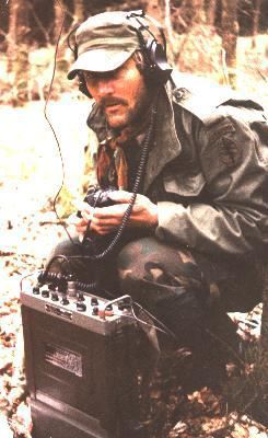
Before we cover the rucks, we remove Andy’s monocular, two HTs and sniper veils. The veils are simple affairs. Each consists of a couple of square feet of light nylon webbing, coyote colored to match the dominant browns present during the winter months in our mountains. Tie on a little jute and burlap then add some local vegetation for texture on the portion that extends over the head and shoulders. In this case, some large brown leaves and tufts of brown grass, leaving the portion of netting that covers the face without garnishment. Each veil is stuffed in a cargo pocket.
The Vortex monocular goes into the zippered pouch mounted under the mag pouches on the front of Andy’s chest rig. The radios are tucked into radio pouches on the front of the plate carriers after checking the freqs against the current SOI and making a quick radio check. We both top-off our camel backs from the collapsible 2 quart canteens stored inside of our rucks. It’s time to issue the 5 point contingency plan.
I look in Jim’s direction and say, ‘You take security, I’ll brief.”
Jim nods and I call the other two over to our position.
Once they have settled in, I lay my map on the ground. Using a small twig as a pointer, I give them the standard five-point contingency plan: GOTWA, where I’m Going and what I’m doing, the Others going with me, the Time we will be gone, What to do if we don’t return on time and Actions to take if either element makes threat contact. *(As found on page 5-13 of SH 21-75, the Ranger Handbook, dated July 1992. In my opinion, the last good Ranger Handbook for dismounted patrolling.)
“Fellas,” I begin, while pointing out the various areas on the map, “This area we had planned on using for the MSS was too exposed, but it looks like this spot will work, so Andy and I are going to recon further west around the peak behind us and take a look at the tentative primary and alternate hide sites, here and here, that we selected during mission planning back at the retreat. Afterward, we will return and start the next phase. If we make any changes you need to know about, we’ll call on the HT. We’ll also give you a heads-up on the radios when we are on our way back.”
“Al, what’s the far recognition signal?” I ask.
“Orange VS-17 challenge, Magenta acknowledge.” he replies, “the running password is “Yosemite Sam” and the number combo is “12”, he adds.
“Good answer. Jim’s the senior man here. We should be gone for no more than 2 hours. If we don’t return by then, move all the sensitive items into your rucks, move unnecessary items to ours. Leave our rucks in the cache, and move to this planned emergency rendezvous point.” I indicate the RV point on the map while adding, “The RV is 100 meters, at 130 degrees azimuth, below the next large mountain peak in the ridge line to the northeast. If either of our elements makes contact with anyone, bad or good, we break contact, pop smoke, and meet at that RV. Any questions?”
No one replies so I add, “Then, per our SOP, wait there 12 hours. If the other team doesn’t show, pull the plug and head home”.
“So we just head on home?” Andy asks, a slight tinge of doubt in his voice.
“You know the deal” Jim replies, looking at him intently. “We activate the E & E plan per the OPORD, we find our way home, you find yours.”
“O.K.” Andy says as he nods in the affirmative. “Just checking.”
“That’s it then, did I miss anything?” I question.
Al speaks up, “I need to cack up several messages for the retreat. The next window will open in about an hour.”
I agree. “Yep, Martin’s probably having a cow about now. He hasn’t heard from us since this morning.”
“Don’t forget ol’ Joe” Jim adds. “He can be a real granny when he’s baby sittin’ those radios of his.”
“You know that’s right.” I reply. “Al, start ginning up the traffic and I’ll look it over before we leave. If you have time while we’re gone, get your comms set up, and when we get back from the recon, you can send it.”
They both nod. Jim stays on security while Al retrieves his notebook to work up the messages.
Andy and I check our camo, weapons and gear.
About the same time we finish, Al hands me the message sheet. It reads:
061355RMAR21 02
INTREP 01
A. 4 EA 16-40 YO WM. 1 WM TATTOS: R/H DIGITS: EWMN. SPIDER WEB AT ELBOW.
B. CHECKING AREA FOR OCCUPIED DWELLINGS, STOP TO CLEAR TREE BLOCKING RD
C. 26549010
D. CIV ATTIRE, MIX STREET/WORK. MOST DIRTY/TORN/WORN. SOME NEW. ONE WM WOODLAND BDU SHIRT “CONNER” NAME TAG & 101st ABN PATCH R/H SLEEVE.
E. 060844RMAR21
F. SMALL ARMS: 1-AR15, 1-SKS, 1-AKM, 1-.22 BOLT RIFLE, NO OPTICS, 2-SIDEARM (1-SEMI, 1-REV, 2-SHEATH KNIFE. COMMS: 1-HT FRS/GMRS. VEH: 1-JOHN DEERE 6 WHL DIESEL UTV MARKED “KYLE TROUT FARM”
INTREP 2
A. EST. UP TO 27 IND. M/F PER TRACKS, W/ 6-HORSE/2-MULE
B. FOOT/HORSE MOUNTED MOVE INTO VIC WHITE OAK FLATS VIA UPPER GOLDMINE RD
C. 26389008
D. UNK
E. 061128RMAR21-TRACKS TO 2 WK OLD
F. UNK
INTREP 3
A. UNK
B. ABANDONED CAMP. NUMEROUS OLD FIRE PIT/PRIM SHELTERS /TRASH /OPEN LATRINES.
C. 26339007
D. UNK
E. 061210RMAR21-UNK OCCUPY/ABANDON DATE
F. EQUIPMENT: UNK
EVTRPT 01
A. CIV FARM CAS: CIV KIA/EXECUTE 2 WM, 30 / 8 YO.
B. RAID/LOOT
C. 26439011
D. 061013RMAR21 3-5 DAYS AGO
E. STRUCT DAMAGE- FIREARM
EVTRPT 02
A. CIV FARM CAS: CIV: KIA/EXECUTE 1 WM, 25 YO. HOSTILE: 2 WM GUN. EVID OF RAPE/ABDUCT 1 F-AGE UNK.
B. RAID/LOOT/BURN
C. 26409013
D. 061057RMAR21 1-2 DAYS AGO
E. STRUCT DAMAGE PYRO/FIREARM
EVTRPT 3
A. CIV HOME.
B. BURN.
C. 26279002
D. 061305RMAR21 UNK DATE
E. UNK
COMINT 02
A. 060835RMAR21
B. 060835RMAR21
C. 462.5625
D. FM
E. PL/CTCSS TONE 67.0
F. 1-S7, 2-S1
G. UNK
J. VOICE 1 “WADE”
L. VOICE 2 “LEWIS”
N. REPORT NO HOUSES ALONG ROAD TO “HIT”. REPORT DETECT SMOKE FROM OUR AO. RETURNING TO VIC VOICE 2.
Q. ONE
COMINT 03
A. 061225RMAR21
B. 061225RMAR21
C. 462.5625
D. FM
E. PL/CTCSS TONE 67.0
F. 1-S8, 2-S2
G. UNK
J. VOICE 1 “FRANK”
L. VOICE 2 “UNK”
N. VOICE 1 ASK ETA FOOD DELIVERY, VOICE 2 REPLY.
Q. ONE
SITREP 02
A. 1&4 MSS, 2&3 RECON
B. EST MSS LOC 2, RECON HIDE-BOTH LOC
C. RECON 061430RMAR21
D. MSS VIC 26268997
I carefully look the messages over for accuracy and brevity, compare them to Al’s message format sheet to check for omissions, then hand the sheet back to Al.
“Al, that’s a lot of traffic. How are you going to send it?”
“Four separate messages” he replies softly while glancing down at the sheets. “The first will be the SITREP to get a feel for how much power I need to get through. The lower I can keep the power, the longer my batteries will last. Once I’ve determined that, then I’ll break up the INTREPs, COMINTS and EVTREPs into the last 3 messages.”
“Good job” I reply.
Al smiles at the compliment with a nod and replies, “I had a good teacher.”
“Do you need help with the encryption?”
“No thanks, by the time you return, I should have them done.”
Turning back to Andy I say, “Okay, let’s go have a look at the primary hide.” I point up the slope “We’ll move a little higher up out of this thicket and then follow the contour around to the north side. You lead.”
“Roger that.” Andy replies, looking up through the thick foliage.
He leads the way up until the thicket thins out and we are again exposed to the cold wind. We then turn back to the right and follow the contour to the northwest. The chill in the wind and snow slashes at our faces. Andy stops just inside the edge of the ivy thicket, kneels and pulls the veil from his cargo pocket. The veils would have snagged in the tangle while we moved through the thicket.
Taking off his boonie, Andy ties the veil to the loops above the brim of his boonie, dons the hat draping the garnished portion of the veil over his head and shoulders while the garnish free portion falls over his face. This allows his view to be unobstructed while still shading and concealing the shape of his face. The familiar shape of his head and shoulders now blend into a brown indistinguishable blob. When he finishes I follow suit.
As I exit the thicket behind Andy, I glance over my right shoulder. Through the bare trees, the open expanse of the western valley below comes into view and I get the uneasy feeling we are being watched. We move slowly and cautiously from one position of concealment to another with frequent looking/listening halts while avoiding areas that will silhouette us along the sky line along the ridge above us. After about 200 meters Andy halts, signals me forward, then drops prone. As I crawl through the leaves next to him he points ahead and up the slope slightly.
“There’s our hide site.” he states confidently. He hands me the Vortex monocular he had been scanning the location with.
I lock both elbows into the ground to stabilize the monocular at my right eye and slowly adjust the focus until the view sharpens. Scanning below the ridge above us I see the large red scar that has been carved out of the steep mountainside. In the years before the collapse, flat landers would build vacation homes, exclusively for the view, on lots high on the mountainsides. Builders had been more than happy to carve a large vertical slice down into the mountain, then scrape out a horizontal ledge to perch a house upon; the locals had no practical use for the steep property.
The lot we were looking at had never been built on. Small pine trees, thick briars and bushes have grown up to choke the flat bottom section of the lot as well as the badly rutted, clay switchback road leading up to it from the valley below. The vertical red clay cliff at the rear of the lot was about 45 feet high at the center apex and sloped down to meet the mountain on both sides about 300 feet across.
The thickly wooded area above the cliff was the spot we were interested in. It would provide great fields-of-view and would be inaccessible to foot traffic from the front unless using climbing gear. Access from each side would be exposed, slow and difficult. Concealment would be adequate but could be enhanced. We could access it from the northern slope via the Rhododendron thicket just below it.
Using the monocular, I study the slope and clay road below the red gash. “No vehicles will be coming up that road” I whispered to Andy. “By the looks of those briars, I wouldn’t want to walk up it either. I can’t make out exactly where the road begins down the mountain. The slope up is pretty steep on this side. I’d like to see the far side. Let’s move back to the top of the thicket, take it up and behind the site, then over to the southwestern side. From there we can look that area over and then move back to the MSS.”
I hand the monocular back to Andy. He slowly lifts the front of his veil and quickly scans the valley below us.
“Don’t see any movement” he says quietly. “Snow’s screwing up the view.”
I follow his gaze. The blowing snow comes toward us in waves across the valley and reduces everything to vague shapes. The low clouds hide the mountain peaks above the valley floor. I can faintly discern the hulking mass of the mountain base to our west.
“Well, I see patches of blue sky, so this snow’s gonna let up soon. But I’d say when it clears out tonight, it’ll get colder than balls,” Andy adds flatly.
“The sooner we get in place the better,” I reply.
Andy pauses scanning for a moment, hands me the mono and points a gloved finger down the mountain, “House…. about 300 meters below the cutout.”
“Good eyes, I missed that one. Looks empty, probably no access to water without electricity, I’d say. What do you think?” I hand the mono back to him.
“That’s what I thought, no danger to us.” he replies as he stows the mono into his pouch, “The dirt road up to it is in pretty rutted.”
We back our way out and find our way back to the top of the thicket, turn right and follow the back side of the spur up to the rear of the area we observed earlier. The location consists of a fairly wide cedar grove. Andy provides security as I crawl closer toward the grove. Looking around I notice the trunk of a large downed poplar tree. The enormous root ball is mostly exposed and has heaved up a large area of earth.
“Andy, let me borrow your glass again.” I whisper.
Rising slowly into a crouch I glass the root-ball area with the mono.
Dropping back to the forest floor I hand the mono back to Andy and say, “All of us can fit in that hole. And from the far side, we should be able to see the target area. If the other side of the mountain checks out clear, this is where I want to set up.”
“All of us? Andy asks.
“Yeah, we’ll close down the MSS and just roll it into the hide. It’s not a problem as long as we are this far from the target. Cuts down on the chances of someone stumbling upon us. Also, from what I’ve seen so far, there’s not much chance of being DF’d by a bunch of jokers using FRS HTs for comms.”
We then move to and visually clear the far side of the mountain, opposite the MSS.
Soon, after alerting Al on our DTR, Andy and I return to the MSS using the same path we exited from earlier.
“Green, Blue, over.”
“Green, over”
“We’re inbound your location, over.”
“Roger, out”