As we continue our movement to the west, a thought nags at me; we’re just getting bits and pieces of the situation in this valley. There’s no way those four knuckleheads in the UTV could have caused all this destruction. It’s imperative that we get to our destination, a hide site on the mountainside overlooking the valley, in order to get a better look at the overall situation.”
During mission planning, we decided that it would be best to take the more populated route, the forest/clearing interface that follows the roads around the valley, rather than taking a direct route going against the grain across the unpopulated mountain spines. Although we would have to be extra cautious to avoid contact with any inhabitants, resulting in slower movement, we would have access to much more information regarding the situation on the ground.
My thoughts are interrupted as we approach a typical small mountain field, some 100 meters across from where we stood. It has been cleared of forest from the road below us to a point about 300 meters up the mountainside. The clearing follows the sides of a small, relatively flat draw, known locally as a holler. It is widest at the road and then tapers to a point at the highest end. The hay stubble is ragged, uneven and cut close to the ground. In the absence of tractor pulled haying equipment, someone has cut the hay by hand, and then stacked it in several piles, 1800’s style, around 20′ long locust poles that have been stood with one end buried into the ground. Only folks with livestock such as cattle or horses would go to the trouble. Considering that the field is not fenced in, then their livestock would not graze there. The hay would have to be transported to the animals. That meant in the absence of a vehicle, the animals must be close by. Most folks in these mountains don’t let their livestock get out of sight these days. Not if you wanted to keep them. My best guess is that unless we come upon another farm shortly, it belonged to the folks in the ruined homestead we just left.
Jim halts inside the tree line, slowly takes a knee behind a tree trunk and sends back the danger area signal. This is not linear danger area like the road we crossed earlier. But it fits the definition of a danger area: an area where the patrol can be exposed to enemy observation and/or fire. Due to the pastures width, we would be in an exposed position much too long if we were compromised while crossing it, and so we use a different method.
Jim scans the far side of the clearing and identifies a large, lone white pine tree standing just inside of the wood line on the opposite side of the pasture. Using his compass, he verifies that the pine is nearly on our azimuth. Once he has chosen the pine as his far-side target, the patrol swings to the left, and staying well back in the wood line, we handrail completely around the southern perimeter of the pasture until we arrive at the pine. Even though it is the only pine of its size in the area, Jim verifies that it is the correct tree. Kneeling near the pine, he shoots the back azimuth to our previous location across the clearing by using the opposite end of the compass needle, in this case the white end, and aligns it with his direction of travel arrow. It matches the general location where we came upon the clearing, 180 degrees out. Satisfied, Jim now designates the lone pine he is next to, as our next rally point, activating the last RP above the earlier Ben Creek crossing point. We then turn back into the woods where we resume the march on our original azimuth.
We enter a dark section of pine forest which has very little underbrush and each man slows without being told, in order to spread our interval. The pines are thick overhead, cutting the wind somewhat. Small snowflakes noticeably drift slowly to the ground around us. After walking quietly across the soft pine needles for about 400 meters, we come to our next planned backstop, the T-shaped road junction made up by the road which we have been hand-railing, and another road coming from the north. Jim stops next to a small pine tree that is surrounded by boot high grass, and looks back toward Andy, watching him slowly scanning his assigned sector; our patrols right flank. Andy slowly moves his head right-to-left and when he finally looks toward him, Jim bends slightly to his left, and, because his boots are not visible in the high grass, touches his support hand to the side of his calf. Pace count. With the signal acknowledged, Jim takes a knee as does the remainder of the patrol, one-by-one. Andy fingers the Ranger beads secured with 550 cord to the front of his chest rig, and counts 4 of the 9 beads pulled up from the knot. Using his support hand, Andy bumps his carbine with his fist, then holds up 4 fingers, bumps it again and points 2 fingers down. 420 meters. Jim acknowledges by giving him the thumbs up.
“Pretty close match” Jim thinks, but quickly verifies his memory is correct by checking his map. Satisfied, we turn on the new azimuth of 200 degrees and continue our march, continuously matching our pace count against the changing contours shown on our maps. The pines give way suddenly to deciduous forest. The forest lightens, the underbrush thickens and the wind picks up again through the bare limbs. We close our interval.
Soon, we come across the faint signs of two old logging roads running perpendicular to our path. Jim’s keen eyes quickly notice subtle differences in the forest; 2 slight, sunken linear depressions running parallel to one another and the sudden dominant presence of thin young pines and poplars growing in the old sunken road beds. While they are so thickly over-grown that neither constitutes a danger area, they show up on the map and match the pace count so we use them as a checkpoint. Jim sends back the rally point signal, indicating a stand of young pines growing on the spot where both old road beds intersect. This activates our last RP at the lone pine on this side of the pasture behind us. We move through the area, passing the RP signal to one another as we each pass the point.
Not long after passing the small crossroads, Jim sees the dark outline of two houses, set close together in the distance, down the steep slope to the west. Stopping to get a look at them with his bino’s, he determines that they’ve long been abandoned. Neither house has a chimney for wood heat, which nowadays is a primary requirement for a dwelling in these mountains. The yards are neglected and wildly overgrown, the forest is reclaiming them. Most of the windows are broken and dark. A tree has fallen against the roof of one and both back doors are standing open. We can just make out the paved road running north and south that the houses front. We move on.
Soon, as we are descending from a spur into a large draw, Jim signals another danger area and he calls me forward. When I join him, he is lying on a bluff that is the lower end of the spur coming down from the mountain above us to the east. We are overlooking a small, noisy, rock filled stream running below and parallel to a dirt road. Jim hands me his open map case and, with the blade of grass he had been chewing on, indicates our location. The name on the map reads “Gold Pit Creek”. Looking up again, I can see that on the far side of the stream is a steep red clay bank about 6 feet high that leads up to the near side of the road bed. The far bank of the road is nearly vertical and about 10 feet high. From the top of the far bank the slope runs straight up the thickly wooded mountainside. Jim bumps my shoulder and when I look his way he mouths the words “Road Bed” and nods toward the road.
Looking down from our vantage point we can see that the road bed has been churned up and is covered by numerous footprints of men as well as the tale-tell sign of horseshoe prints. It appears that a small army has passed down the road into the valley below. Another piece of the puzzle falls into place.
Jim bumps me again and whispers “Head Count”?
I think to myself, “Good idea”. We were sent here to recon the valley. The “S” in SALUTE stands for Size of Enemy Unit. Just because we don’t have eyes on the folks that came down the road doesn’t mean we can’t use this opportunity to get a head count. We can see that the footprints are filled with water, so they’re not new, which means there’s a good chance no one is in the immediate area. Establish a listening halt for a few minutes, then put out security; far side, up and down the road then let Andy put his tracking skills to work.
I look at Jim and give him a thumbs up. We watch and listen for 15 minutes.
During the listening halt I look the trail over for a relatively hard packed and dry stretch of the road to use as our crossing point. Luck is with us and I spot an area where the creek bank on both sides is covered with laurel. Unless someone traveling down the road climbs into the laurel thicket, they won’t see any slide marks we might inadvertently leave while climbing the slick red clay of the opposite bank in order to cross the road. In fact, with the loads we are carrying, it’d be a miracle not to leave a very obvious trail. The far side road bank at that location is also covered with the same Ivy and appears to be much shorter there also. I signal “scroll-to-the-road” to Jim and indicate the crossing point. Then I pass the signal back. We move to the left a few yards and enter the thicket. Jim carefully crosses the stream, avoiding stepping on the moss-covered rocks. The stream itself is too choked with vegetation to be considered a danger area, and he slowly moves up through the laurel tangles to the lip of the road where he alternately peers down its length in both directions.
When he is satisfied the way is clear, he signals me forward to his position. I pick my way across the stream and push through the tangled thicket as quietly as possible. Moving individual branches aside to avoid breaking them, I finally reach him and bump him across. Once he has cleared to the far side. I signal Andy forward. He then moves silently across and up the bank. When he joins me I notice his face is red and sweat streaked. I wonder how I look. When he bumps me, I cross quickly, still watching up the road and bump Jim, who moves to a point further up the opposite slope and deeper into the woods. He disappears from my view into a stand of low growing holly trees. I trust him to still have us under his observation.
When Andy is bumped by Al and joins me, I point to him, signal “head count” by tapping my head, and point to the tracks on the road. I then indicate myself, then signal security to a position up the road, followed by indicating Al, make the security signal again, and indicate down the road. Andy nods “OK” and I head up through the brush along the road for about 30 meters where I can just make him out down the road. When Andy sees that I am in place, he signals Al to cross, who then gets his assignment from Andy, and moves down the road to his security position.
Al is lying near the upper bank of the road, well hidden under a long, tangled hedge of blackberry briers, where he is peering down the length of the road below. He chose this position for two reasons. “First,” he thinks, “I’m only about 100 meters from the junction of the two lower roads. If we get compromised and they have horses or vehicles, they will be below us pretty quick but the steep bank and the briers will slow them down. Then we head up hill into the thick stuff. If the riders are stupid enough to pursue us through the low hanging branches, horses make big targets. Just don’t get intimidated by them.”
“Second reason,” he muses, “This is the only concealment on this side of the road.”
Confident that we are adequate security, Andy stands a few feet away from the road at the foot of the bank looking over the area for a few moments. He is looking for a soft spot that will reveal all the “ground spoor”, or tracks, of those who passed this way. He notices a low pine bough overhanging the road that has been partially broken and is dangling in the direction of travel. Inspecting the break closer, he sees that the pine sap has started to harden and turn white giving an indication of time. In tracking parlance, this is known as “aerial spoor”. Along the road side he finds a bit of “litter”. It is a brown cloth glove partially buried in the mud.
Finding a low, silted up section of the road, he squats near it and begins studying the tracks. The water standing in each is clear. If they had been recent, the water in each would still be muddy. Andy also notices that quite a bit of forest debris, such as leaves, have blown into the some of the tracks and settled to the bottom and each bit covered with a thin, watery layer of silt. The top edges of the foot prints are crumbling and worn down, not crisp and sharp.
“Definitely not today” he thinks to himself.
Andy studies a strung out pile of horse manure or “road apples”. The lumps have started to dissolve and have begun to turn from their normal dark brown color to gray. This falls into the tracking category of “sign”.
“These tracks are several days, but not more than 2 weeks old.” he decides. “Fortunately, this is the only rain we’ve had during past two weeks and they haven’t washed all of the detail away.”
Looking closer at the tracks he quickly identifies the distinctive tread of a boot. He then locates matching right and left boot prints. This is the “key print” he has been looking for. Andy lays a long thin branch across the road at the heel of the rear print. Next he lays another similar branch across the instep of the forward print. He then counts all the full footprints in between the two branches. 1 footprint for every person meant that approximately 16 men and 3 women (indicated by their smaller, narrower prints) have passed this way on foot. The size of the prints indicates they were all adults.
“No one is barefooted” he thinks to himself.
Some of the prints are deeper and the strides are much shorter. The heels and toes of these prints show long drag marks with each step.
“Huh, looks like some of them were carrying heavy loads” he notes.
Andy turns his attention to the hoof prints of the horses. He moves a few yards up the road to a drier, rockier area. All appear to be shod. By the way the triangular-shaped, flatter toed, rear prints are nearly over the more rounded front prints, he determines they were walking slowly. The flatness and depth of the prints indicates they were all loaded with riders or gear.
“That’s odd” Andy frowns while peering at 2 peculiar sets of hoof prints. “These aren’t horse prints. They’re too small and more angular shaped.”
He rocks back on his heels for a few moments, thinking. “I’ve seen these before but where”? he mutters to himself. Suddenly he remembers:
“Mules,” he breathes quietly to himself, Old Jack’s mules out in Sanderstown. That’s it. So, O.K., here we have 2 mules…and they’ve been shod…., that’s really odd. Most folks around here don’t bother to shoe their mules unless they are working them on pavement or gravel. And I don’t know anyone around here that does. Well, let’s see what we’ve got here”
Laying out another area spanning roughly 36 inches, he determines there are 8 individual sets of hoof prints.
“If all the horses and mules had riders,” he thinks to himself, “the final count would be around 27 people passed down the trail. Unless they were both pack mules. Then it would be 25”
After looking over the area for a few more minutes to see if he missed anything important, Andy is satisfied with his numbers. He retrieves the 2 sticks, tosses them into the woods, signals Al and I to rally on him and, working his way up the steep slope joins Jim further into the woods. Jim is cloistered in the thick holly grove well above the road. We have a perfect over watch.
Andy gives us the head count and other particulars.
“Do you think they all went on down the road”? I ask.
“Looks like it from here. He replies. No telling where they got off though. We’d have to follow both sides of the road down to the road junction to see which way they went then follow it to their exit point to be sure.”
“We’re definitely not doing that”. I replied flatly. “Anything else”?
“They were pretty spread out across the road, that made it easier to get the count. If they had any military training I would expect to see the tracks in 2 single files one on each side of the road. Then it would have been a lot harder to get a number, what with the rain and all”
“If they had any training worth a darn or some common sense, there wouldn’t be any tracks on the road. They should’a hand-railed it.” Jim adds, then turns his gaze back to his sector.
“Yeah, but then not everybody can be as tough as you are Jim”. Al adds quietly, with an impish smile.
Jim glares at him or a moment, then retorts as he looks away, “You forgot to add that I’m also a freakin’ military genius”. I can see the satisfied grin on Jim’s face as he continues to look over his sector.
“Or maybe they weren’t worried about being followed. Jim, you still good with point”? I ask.
“No problem” he replies.
“Then let’s do it”
We continue on azimuth for roughly 30 minutes when Jim stops and signals me forward once again. When I join him behind the trunk of a large oak tree, he is staring intently through the trees to an area down the slope about 50 meters away. There, beneath the trees, is a large area at least 100 meters across where the brown winter vegetation has been beaten down and the ground churned into mud. Numerous old fire pits are visible at various locations around the camp, each near crude shelters that were constructed from forest material and roofed with pieces of blue or green tarps. Litter is everywhere as well as discarded articles of clothing. Stumps reveal where many smaller trees have been chopped down, while the larger trees that haven’t been felled are missing every limb within reach of the ground. The wind is blowing in our face and carries with it the reek of unburied human feces and urine, mixed with the smell of wet wood ashes and cooked food.
From what we can observe from our position it appears that the large party that moved down Gold Pit Road, had taken the left fork and traveled using the dirt road below us. Then they camped here for several days before moving on. With our binoculars we can see the route they took from the camp through the woods further down the spur to the hard ball road. They went south straight into the upper section of the valley.
How the residents of the valley didn’t discover them is beyond me. Nearly 30 persons on horseback and foot, cutting trees and burning fires nearby is not something you would miss if you were conducting even rudimentary security patrols in your AO. Then, thinking back, I recalled during our mission brief, Joe had passed on details regarding his previous radio conversations with his friend Jack Conner. Jack had stated that the homesteads in his community were fairly scattered and while the families got along and helped one another, they tended to resist any organization, preferring to keep to themselves and their extended families. That lack of basic organization and streak of independence may have cost them dearly.
“Wonder why they left their tarps on the hooches?” Jim asks quietly.
I think about it for a second and reply. “Maybe they figured they wouldn’t need them anymore. They had found new digs.”
Jim just grunts.
Feeling too exposed near the old camp we decide to move out and so, soon we find ourselves back on our azimuth, again slowly following the contours of the unfolding terrain. We don’t stop to eat, but push ourselves to stay alert and to ignore our aching backs and tired legs as well as the freezing sleet and wind.
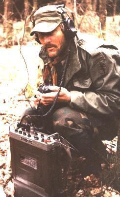
At one point Al picks up additional radio transmissions on the same frequency as earlier and stops to transcribe the traffic. He finishes quickly and I look over the sheet. Same freq. as before, one transmission with a much stronger signal strength.
A weak signal sending: “Hey this is Frank, where’s our food, when will it get here?”
A much stronger signal answers: “Frank, quit yer whinin’. It’s on the way”.
Soon after we resume movement, we hear the sound of the little diesel engine from the UTV passing some distance off to the west. We go to ground and attempt to get a visual on its location but the forest is too thick and soon the sound fades off behind the long ridge bisecting the valley.
Rucking up, we pick up the march again. As we move through the forest we occasionally catch the smell of wood smoke in the wind coming from the west. The sleet is starting to mix with small snowflakes as the temperature steadily continues to drop and the wind increases. After 2 hours of slow but continuous movement we stop well behind a large home situated squarely in our planned route.
Jim spots it from point, calls a halt and signals me forward. Again I move to the front of the column, where he points out the house in the distance through the trees. Jim retrieves his aerial photo of the A.O. and passes it to me. The house isn’t on the older topo map but the newer aerial photo shows it situated about 15 meters on this side of the road that we were intending to use as our backstop. I wonder to myself how we missed it on the photo during our pre-mission planning.
With our glasses, we can just make out a roof line with two large dormer type windows attached. Dark black scorch marks above both window openings indicate that this home too has been attacked and if it fits the model, probably ransacked, then set ablaze. Due to the thickness of the trees between our location and the house, we can’t observe the lower floor or the ground surrounding it. We decide to give it a wide berth.
I point to the east and give Jim the hand-and-arm signal for 200 meters. Jim looks over his map and the photo for a few moments, then gives me the thumbs up and dials in the new azimuth of 110 which is a 90 degree offset from the original azimuth.
Soon we are perched on a small knoll overlooking a paved road known locally as Forest Service Road 711. The road follows a deep, steep-sided gorge which separates us from our final destination, Holloway Branch Ridge. 711 is a wide paved road with narrow ditches on each flank. The ditches are now overgrown and the road has been made impassable down it’s length by random dead fallen timber. At first glance I think someone has deliberately blocked the road by dropping dozens of tree across it, but then realize that the stumps are not the clean, neat cuts made by a saw. They are mostly ragged and occur at random heights above the ground. Some of the trees entire root ball has been upended out of the ground. This is just nature doing what it does in these mountains.
I remember that this road was once a favorite of hunters, fishermen and sightseers in times past when gasoline was commonly available. It started on the edge of the wilderness and ended on the opposite end with only thickly wooded and wild National Forest between. When the Forest Service went away due to lack of funds, road maintenance and downed tree clearance on these isolated roads ended. This is good for us since the road cannot be used as a high-speed avenue-of-approach. In layman’s terms, we don’t have to worry the off-chance that bad guys in wheeled vehicles or horses using it to quickly bear down on us as we cross it. The downed timber actually gives us quite good cover and concealment and the crossing is made without incident.
Once on the far side of the road, Jim leads us across White Oak Creek, a wide, shallow, but swift moving stream. This creek is so wide and straight, that we treat it as a linear danger area and cross it accordingly. Now we slip again into the dark, tangled laurel that chokes all normal movement.
As we push through the tangled mass, guided by the sound of water splashing across the rocks ahead, Al is checking our back trail. He sees a branch that has been freshly broken by our passage and retrieves a small folding multi-plier from one of the pistol mag pouches attached to the front of his plate carrier. He cuts the branch cleanly at an angle next to a leaf junction below the break and then shoves the cut branch, break down into a small space between the river rocks at his feet.
“It won’t fool a good tracker, but it’s not obvious to the average guy” Al thinks as he continues his scans.
Finally we clear the laurel and wade up a small stream that runs perpendicular to, and feeds the larger creek we left behind. Named “Holloway Branch” it leads up into a small isolated valley. Once in the cove, we ascend up the east face of the mountain and deeper into the valley that we have designated to establish our patrol base in. At about 700 meters I send up the signal for the “J” hook to over-watch our back trail. Exhausted and panting from the climb up the steep slope, we drop into our ambush positions per our SOP. Though our sweat soaked clothing is uncomfortable in the cold air, we are all grateful for the few minutes to rest our aching legs and shoulders during the listening halt.

